
UNDERSTANDING SURF FORECASTING
SURFING ADVICE
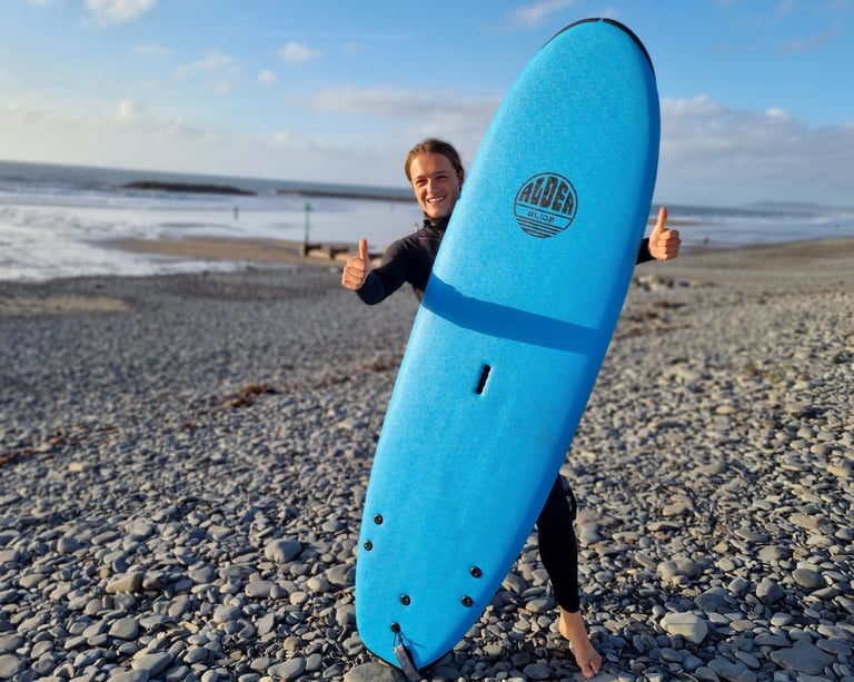
Learning how to forecast surf is a true art and will take a while to really get the hang of. Hopefully this guide will help you to understand a little more.
Surf forecasting, like weather forecasting has come a long way in the last 30 years.
The arrival of surf, wind and weather can now all be predicted with relative accuracy, using sophisticated computer modeling, and live data from multiple points, in the ocean and atmosphere.
There are literally dozens of apps and online tools that take some of the guesswork out of trying to predict when surf will arrive. Windfinder, Windy, Surfline, Windguru are rated among the best.
Unfortunately they do not take into consideration the multiple local variations, that can affect wave quality and size.
Even with the incredible accuracy of these tools, many surfers still end up getting skunked.
This is a very basic guide, into the very complex science of wave creation.
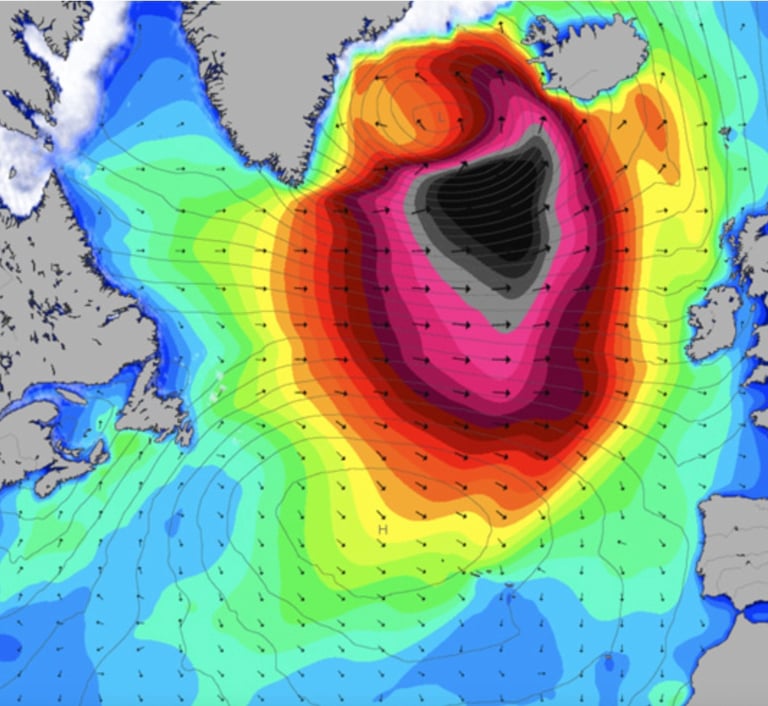
Surf is created by wind blowing across the surface of the water. The three main factors that create waves are; the strength of the wind, the duration, and the fetch (distance over which the wind blows). If the wind blows strong enough, for long enough, over a long enough distance, swell is produced. This swell can travel for thousand of miles across open ocean, before hitting the shallow waters surrounding land, and creating breaking waves.
Swell height and wave height.
Swell height is the height of the swell as it travels through deeper open ocean. Wave height is the actual height of a wave when it is breaking. The height is measured from the lowest point (the trough) to the highest, (crest).
Period
Swell or wave period is the distance between 2 waves crests. The further a swell travels the longer the period becomes, and the faster the swell will travel. Wave period is a very important factor when forecasting.
THE BASICS
There are many factors that will affect the size and quality of the waves at the beach. Unfortunately technology cannot help much with learning the complexities of local knowledge. Like surfing this can only really come with experience and spending time surfing at the spots you want to learn.
Tide. Read our blog on Understanding Tides
This will have a massive effect! Which tide does the spot work best on? High tide or low tide? Incoming or outgoing (ebbing or flowing)? What will the tidal range do to the surf, (neap tides or spring tides). Some spots can can have amazing surf at high and then be flat at low tide, even though the swell hasn't changed. We have massive tidal ranges in the UK, south Wales, can expiernce 9m difference between low and high tides. Learn about the tides, they are vital to understanding when is best to surf.
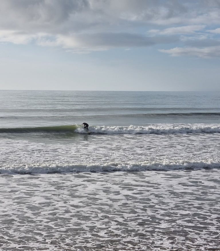
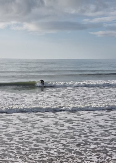
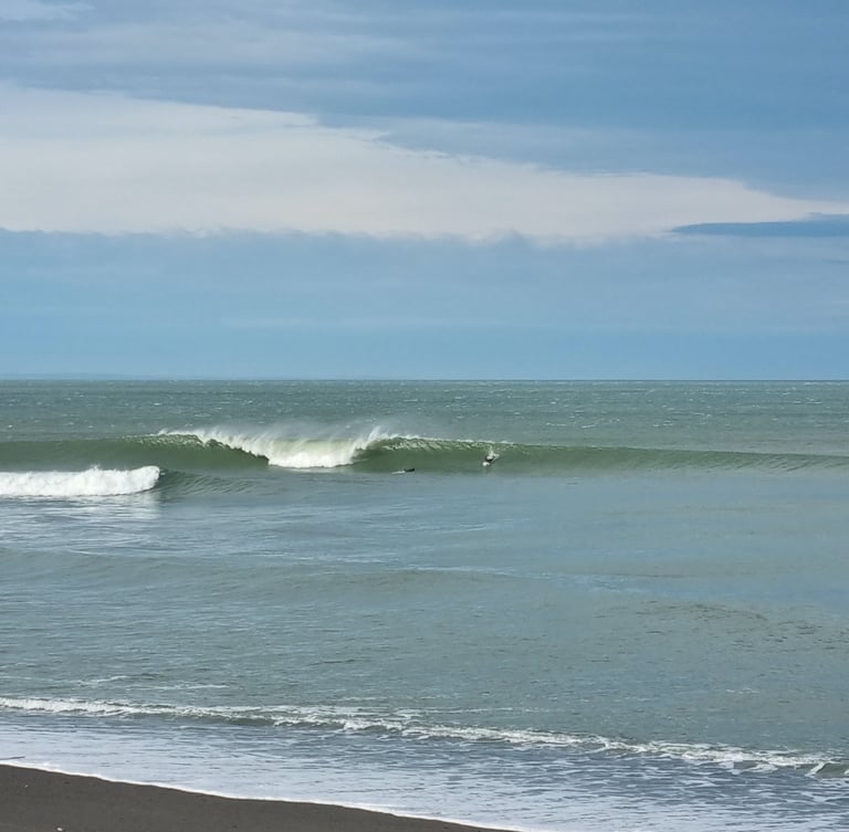
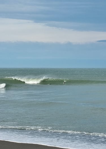
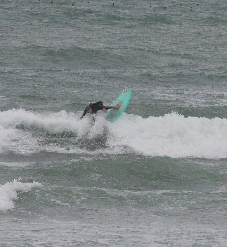
Groundswell (top photo)
When a swell generated far out in the ocean, leaves the windy conditions of the storm and begins to travel, it is then classed as a groundswell. Ground swells are generally considered to be swells with a wave period greater than 10 seconds. Groundswells generally offer better waves, with more power
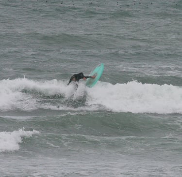
Windswell (bottom photo)
When the swell has low wave period (less than 10 seconds) it is generally considered to be a windswell. Often weak and harder to surf, due to the lack of power. Very often local onshore wind will create enough to surf, but it will be choppy, messy, weak and hard to read the waves.
Local Wind. Onshore or offshore?
An offshore wind (shown in top picture) is when the wind blows from land out to sea, creating clean waves, and lines of surf. An on shore wind (bottom photo) is the opposite. Wind blowing from sea onto the land, generally creating choppy conditions and messy waves, (if the wind is blowing strong enough).
Bathymetry
Simply put the sea floor. Gently sloping beaches (like Borth and Ynyslas) create mellow waves that are great for learning and progressing. Sand on beaches can move around and sandbars, can change within hours. Waves breaking on reefs, are generally powerful and not suitable for those learning to surf.
LOCAL VARIATIONS
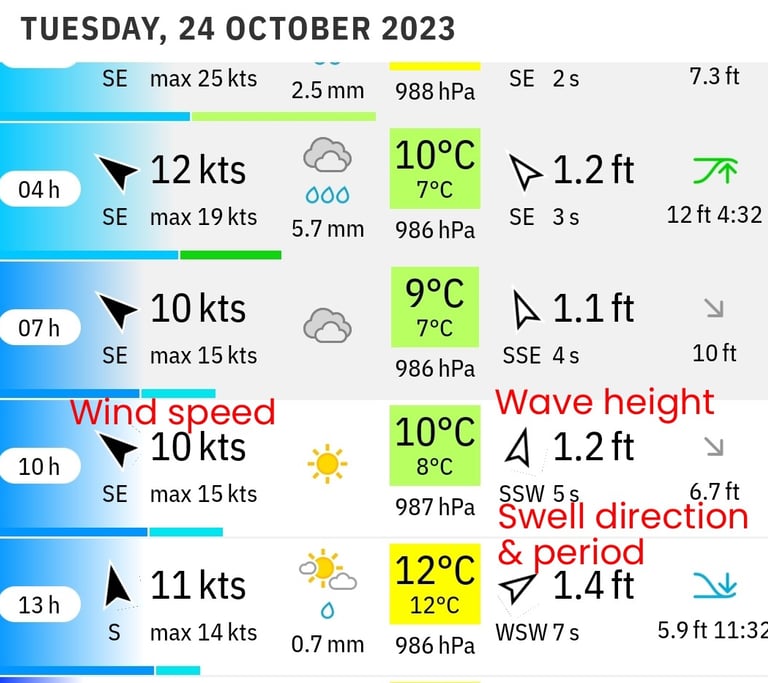
Wind Speed
Wind can be measured in knots (kts, nautical miles per hour), miles per hour (mph), kilometres per hour (kph) or using the beaufort scale. Most surf forecasting apps will allow you to pick the most relevant one for you. The bold top figure is the average wind speed, the lower figure highlights the maximum gusts. Th arrow indicates wind direction and SE (south east) indicates the compass point the wind is blowing from.
Wave height
In the case of this forecast it relates to, actual wave height expected to be breaking at the beach. SSW (south south west) and the arrow indicates the swell direction it has travelled from. 5s indicates the swell period in seconds.
Tidal information
The figures on the far right of the screen shot indicate high tide height and time (green icon), and lower down low tide height and time (blue icon).
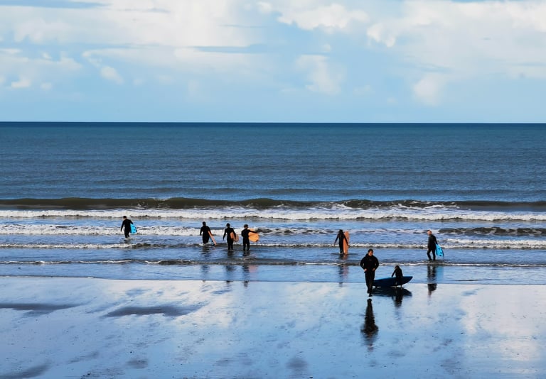
What does this forecast actually look like at the beach?
Firstly based on this forecast for 10am, the waves are not expected to be that good, if any at all! The wind is relatively light and blowing cross offshore, so sea conditions should be relatively clean. However the wave height is very low 1.2 feet, (32cm) and low wave period indicate very weak windswell waves, swell direction is also not great as Pembrokeshire should be blocking the swell from reaching us in mid Wales.
The picture was taken at 10.30am. The waves are definitely short period, but the wave height and direction is definitely wrong. This highligts how inaccuarte an online surf forecast can be.
UNDERSTANDING A FORECAST
As highlighted above just using an online forecast can often be inaccurate. Most experienced surfers only ever use online forecasts as a rough guide, cross referencing with many other tools to accurately forecast surf.
Webcams
Probably the greatest asset at any surfers disposal are coastal webcams. Most of the UK has a webcam relatively close to the spot you want to surf. As long as the webcam is on the same stretch of coast, and the spot faces the same direction, it will give you eyes on what is actually happening.
Local Weather Stations
There are thousands of private weather stations covering the globe. A good app giving public access to data is the Davies WeatherLink. These stations will give you up to the minute infomation on local wind.
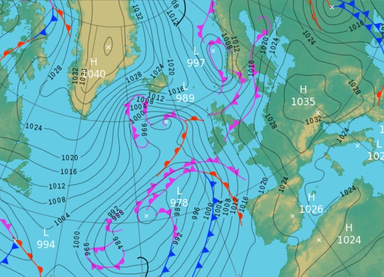
Surface Pressure Charts and Wind Maps
Learn how to read pressure charts, specifically the nature of low and high pressure systems, and their associated isobars. There are many online tutorials and blogs. Once you understand these you can predict when and where swells are generated. Many apps like Windy will show surface pressure and surface wind on the same map.
Make Notes
Make notes of what the forecast was and what the actual conditions were. This will help you to learn when conditions are good. There is even an app called Lazy Surfer, an online digital surf journal that also logs the conditions.